Almoharín
Place in Extremadura, Spain

Flag

Seal
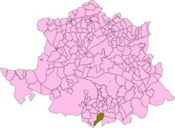
Map of Almoharín
(2018)[1]
Almoharín (Spanish pronunciation: [al.mo.aˈɾin]) is a municipality located in the province of Cáceres, Extremadura, Spain. According to the 2005 census (INE), the municipality has a population of 2050 inhabitants.
The village's economy is primarily agricultural, with many inhabitants having fincas of olives and figs. Almoharin is known[by whom?] as the 'Fig Capital of the World' on account of these figs, which are green and smooth-textured. Both dried figs and chocolate figs are exported worldwide. The village also has a cheese-making workshop where visitors can make their own cheese - after milking the sheep. There is an accompanying exhibition of the history of sheep and cheese-making in the area.
Almoharin has a 16th-century church, and a traditional plaza. The Roman bridge, just outside the village, is the oldest architectural remains in the area.
References
- ^ Municipal Register of Spain 2018. National Statistics Institute.
External links
 Media related to Almoharín at Wikimedia Commons
39°10′N 6°02′W / 39.167°N 6.033°W / 39.167; -6.033
- v
- t
- e
- Abadía
- Abertura
- Acebo
- Acehúche
- Aceituna
- Ahigal
- Alagón del Río
- Albalá
- Alcántara
- Alcollarín
- Alcuéscar
- Aldea del Cano
- Aldeacentenera
- Aldeanueva de la Vera
- Aldeanueva del Camino
- Aldehuela de Jerte
- Alía
- Aliseda
- Almaraz
- Almoharín
- Arroyo de la Luz
- Arroyomolinos
- Arroyomolinos de la Vera
- Baños de Montemayor
- Barrado
- Belvís de Monroy
- Benquerencia
- Berrocalejo
- Berzocana
- Bohonal de Ibor
- Botija
- Brozas
- Cabañas del Castillo
- Cabezabellosa
- Cabezuela del Valle
- Cabrero
- Cáceres
- Cachorrilla
- Cadalso
- Calzadilla
- Caminomorisco
- Campillo de Deleitosa
- Campo Lugar
- Cañamero
- Cañaveral
- Carbajo
- Carcaboso
- Carrascalejo
- Casar de Cáceres
- Casar de Palomero
- Casares de las Hurdes
- Casas de Don Antonio
- Casas de Don Gómez
- Casas de Millán
- Casas de Miravete
- Casas del Castañar
- Casas del Monte
- Casatejada
- Casillas de Coria
- Castañar de Ibor
- Ceclavín
- Cedillo
- Cerezo
- Cilleros
- Collado
- Conquista de la Sierra
- Coria
- Cuacos de Yuste
- Deleitosa
- Descargamaría
- El Gordo
- El Torno
- Eljas
- Escurial
- Fresnedoso de Ibor
- Galisteo
- Garciaz
- Garganta la Olla
- Gargantilla
- Gargüera
- Garrovillas de Alconétar
- Garvín
- Gata
- Guadalupe
- Guijo de Coria
- Guijo de Galisteo
- Guijo de Granadilla
- Guijo de Santa Bárbara
- Herguijuela
- Hernán-Pérez
- Herrera de Alcántara
- Herreruela
- Hervás
- Higuera
- Hinojal
- Holguera
- Hoyos
- Huélaga
- Ibahernando
- Jaraicejo
- Jaraíz de la Vera
- Jarandilla de la Vera
- Jarilla
- Jerte
- La Aldea del Obispo
- La Cumbre
- La Garganta
- La Granja
- La Pesga
- Ladrillar
- Logrosán
- Losar de la Vera
- Madrigal de la Vera
- Madrigalejo
- Madroñera
- Majadas
- Malpartida de Cáceres
- Malpartida de Plasencia
- Marchagaz
- Mata de Alcántara
- Membrío
- Mesas de Ibor
- Miajadas
- Millanes
- Mirabel
- Mohedas de Granadilla
- Monroy
- Montánchez
- Montehermoso
- Moraleja
- Morcillo
- Navaconcejo
- Navalmoral de la Mata
- Navalvillar de Ibor
- Navas del Madroño
- Navezuelas
- Nuñomoral
- Oliva de Plasencia
- Palomero
- Pasarón de la Vera
- Pedroso de Acim
- Peraleda de San Román
- Peraleda de la Mata
- Perales del Puerto
- Pescueza
- Piedras Albas
- Pinofranqueado
- Piornal
- Plasencia
- Plasenzuela
- Portaje
- Portezuelo
- Pozuelo de Zarzón
- Puerto de Santa Cruz
- Rebollar
- Riolobos
- Robledillo de Gata
- Robledillo de Trujillo
- Robledillo de la Vera
- Robledollano
- Romangordo
- Rosalejo
- Ruanes
- Salorino
- Salvatierra de Santiago
- San Martín de Trevejo
- Santa Ana
- Santa Cruz de Paniagua
- Santa Cruz de la Sierra
- Santa Marta de Magasca
- Santiago de Alcántara
- Santiago del Campo
- Santibáñez el Alto
- Santibáñez el Bajo
- Saucedilla
- Segura de Toro
- Serradilla
- Serrejón
- Sierra de Fuentes
- Talaveruela de la Vera
- Talaván
- Talayuela
- Tejeda de Tiétar
- Tiétar
- Toril
- Tornavacas
- Torre de Don Miguel
- Torre de Santa María
- Torrecilla de los Ángeles
- Torrecillas de la Tiesa
- Torrejón el Rubio
- Torrejoncillo
- Torremenga
- Torremocha
- Torreorgaz
- Torrequemada
- Trujillo
- Valdastillas
- Valdecañas de Tajo
- Valdefuentes
- Valdehúncar
- Valdelacasa de Tajo
- Valdemorales
- Valdeobispo
- Valencia de Alcántara
- Valverde de la Vera
- Valverde del Fresno
- Viandar de la Vera
- Villa del Campo
- Villa del Rey
- Villamesías
- Villamiel
- Villanueva de la Sierra
- Villanueva de la Vera
- Villar de Plasencia
- Villar del Pedroso
- Villasbuenas de Gata
- Zarza de Granadilla
- Zarza de Montánchez
- Zarza la Mayor
- Zorita

| Authority control databases |
|
|---|
 | This article about a location in the autonomous community of Extremadura, Spain is a stub. You can help Wikipedia by expanding it. |
- v
- t
- e


