Berrabi Bakhti
Village in Béchar Province, Algeria
30°50′57″N 1°59′58″W / 30.84917°N 1.99944°W / 30.84917; -1.99944 Algeria
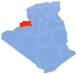
Berrabi Bakhti is a village in the commune of Taghit,[1] in Taghit District, Béchar Province, Algeria. The village is located on the eastern side of the Oued Zouzfana 8 kilometres (5.0 mi) south of Taghit, on the western edge of the Grand Erg Occidental.[2]
References
- ^ a b "Décret n° 84-365, fixant la composition, la consistance et les limites territoriale des communes. Wilaya d'El Oued" (PDF) (in French). Journal officiel de la République Algérienne. 19 December 1984. p. 1489. Archived from the original (PDF) on 21 October 2013. Retrieved 2 March 2013.
- ^ "Bakhti, Algeria". GeoNames. Retrieved 7 May 2013.
Neighbouring towns and cities
Places adjacent to Berrabi Bakhti | ||||||||||||||||
|---|---|---|---|---|---|---|---|---|---|---|---|---|---|---|---|---|
| ||||||||||||||||


- v
- t
- e
Capital: Béchar
- Taghit
- Berrabi Bakhti
- Zaouia Foukania
 | This article about a location in Béchar Province is a stub. You can help Wikipedia by expanding it. |
- v
- t
- e


