Bodva
River in Slovakia and Hungary
48°12′30″N 20°46′29″E / 48.2084°N 20.7746°E / 48.2084; 20.7746The Bodva (Hungarian: Bódva, Slovak: Bodva, German: Bodwa) is a 110-km long river in Slovakia and Hungary. Its source is in the Slovak Ore Mountains. The river crosses the border with Hungary near Turňa nad Bodvou, and flows into the river Sajó in Boldva, north of Miskolc. Within Slovakia, its length is 47 km (29 mi) and its basin size is 866 km2 (334 sq mi).[1] Two of its tributaries are the Turňa and the Ida.[1]
The Bodva flows on the eastern edge of a karstic rock system, therefore it has an unsymmetrical drainage pattern. Up to Medzev, where the river reaches the karst region, and on its left side the Bodva river has a typical treelike river system.
References
- ^ a b Plán manažmentu povodňového rizikavčiastkovom povodí Bodvy, p. 27
- v
- t
- e
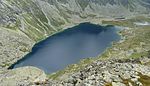
Hydrography of Slovakia
| Black Sea basin |
| ||||
|---|---|---|---|---|---|
| Baltic Sea basin |
|
| Tarns in Tatra Mountains | |
|---|---|
| Other natural lakes |
|
| Váh basin |
|
|---|---|
| Other |
|
Authority control databases | |
|---|---|
| International |
|
| National |
|
This article related to a river in Slovakia is a stub. You can help Wikipedia by expanding it. |
- v
- t
- e
This article related to a river in Hungary is a stub. You can help Wikipedia by expanding it. |
- v
- t
- e


