Chapadinha
Municipality in Northeast, Brazil

Flag
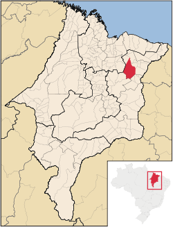
Location in Maranhão state
(2020 [1])
Chapadinha is a Brazilian municipality in the state of Maranhão. It is located 235 km south-east of the state capital São Luís. The population is 80,195 (2020) and the total area is 3,247 km2.
The municipality lies in the Munim River basin.[2] The municipality contains the 11,971 hectares (29,580 acres) Chapada Limpa Extractive Reserve, created in 2007.[3]
Climate
Chapadinha experiences a tropical savanna climate (Köppen: Aw) with hot temperatures and distinct wet and dry seasons. The city experiences a wet season from January to May. The dry season extends from July to November.
| Climate data for Chapadinha (1991–2020) | |||||||||||||
|---|---|---|---|---|---|---|---|---|---|---|---|---|---|
| Month | Jan | Feb | Mar | Apr | May | Jun | Jul | Aug | Sep | Oct | Nov | Dec | Year |
| Mean daily maximum °C (°F) | 32.8 (91.0) | 32.0 (89.6) | 31.7 (89.1) | 31.7 (89.1) | 31.8 (89.2) | 31.7 (89.1) | 32.3 (90.1) | 34.1 (93.4) | 35.6 (96.1) | 36.3 (97.3) | 35.8 (96.4) | 34.9 (94.8) | 33.4 (92.1) |
| Daily mean °C (°F) | 26.8 (80.2) | 26.4 (79.5) | 26.2 (79.2) | 26.4 (79.5) | 26.8 (80.2) | 26.7 (80.1) | 26.8 (80.2) | 27.3 (81.1) | 28.1 (82.6) | 28.5 (83.3) | 28.5 (83.3) | 28.0 (82.4) | 27.2 (81.0) |
| Mean daily minimum °C (°F) | 23.1 (73.6) | 23.0 (73.4) | 23.0 (73.4) | 23.2 (73.8) | 23.3 (73.9) | 22.8 (73.0) | 22.3 (72.1) | 22.4 (72.3) | 22.9 (73.2) | 23.3 (73.9) | 23.7 (74.7) | 23.7 (74.7) | 23.1 (73.6) |
| Average precipitation mm (inches) | 227.7 (8.96) | 275.1 (10.83) | 359.1 (14.14) | 331.7 (13.06) | 196.5 (7.74) | 69.3 (2.73) | 27.0 (1.06) | 5.9 (0.23) | 2.5 (0.10) | 16.6 (0.65) | 38.3 (1.51) | 84.3 (3.32) | 1,634 (64.33) |
| Average precipitation days (≥ 1.0 mm) | 12.7 | 15.1 | 19.4 | 18.4 | 12.6 | 6.5 | 3.2 | 0.6 | 0.6 | 1.1 | 2.2 | 5.1 | 97.5 |
| Average relative humidity (%) | 78.0 | 82.5 | 85.3 | 85.8 | 82.7 | 78.0 | 72.6 | 66.3 | 63.3 | 62.4 | 64.3 | 68.1 | 74.1 |
| Average dew point °C (°F) | 23.1 (73.6) | 23.6 (74.5) | 23.9 (75.0) | 24.1 (75.4) | 24.0 (75.2) | 23.1 (73.6) | 22.1 (71.8) | 21.4 (70.5) | 21.2 (70.2) | 21.3 (70.3) | 21.7 (71.1) | 22.2 (72.0) | 22.6 (72.7) |
| Mean monthly sunshine hours | 190.7 | 169.5 | 174.9 | 180.5 | 221.6 | 250.6 | 276.5 | 305.0 | 292.7 | 282.0 | 243.6 | 230.4 | 2,818 |
| Source: NOAA[4] | |||||||||||||
References
- ^ IBGE 2020
- ^ Comitê de Bacia Hidrográfica do Rio Munim convoca primeira assembleia (in Portuguese), Governo do Maranhão, 14 September 2015, archived from the original on 11 February 2017, retrieved 2017-02-09
- ^ RESEX Chapada Limpa (in Portuguese), ISA: Instituto Socioambiental, retrieved 2016-08-31
- ^ "World Meteorological Organization Climate Normals for 1991-2020 — Chapadinha". National Oceanic and Atmospheric Administration. Retrieved January 30, 2024.
- v
- t
- e

Capital: São Luís
Centro Maranhense | |
|---|---|

Leste Maranhense | |||||||||||||
|---|---|---|---|---|---|---|---|---|---|---|---|---|---|
| |||||||||||||
Norte Maranhense | |||||||||||||
|---|---|---|---|---|---|---|---|---|---|---|---|---|---|
| |||||||||||||
Sul Maranhense | |||||||
|---|---|---|---|---|---|---|---|
| |||||||
Authority control databases | |
|---|---|
| International |
|
| National |
|
 | This Maranhão, Brazil location article is a stub. You can help Wikipedia by expanding it. |
- v
- t
- e


