Cheesequake, New Jersey
Populated place in Middlesex County, New Jersey, US
Unincorporated community in New Jersey, United States
Cheesequake, New Jersey Chiskhakink (Unami) | |
|---|---|
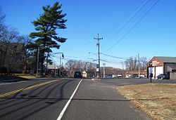 Center of Cheesequake along Route 34 | |
40°25′29″N 74°17′16″W / 40.42472°N 74.28778°W / 40.42472; -74.28778 | |
| Country |  United States United States |
| State |  New Jersey New Jersey |
| County | Middlesex |
| Township | Old Bridge |
| Elevation | 102 ft (31 m) |
| Time zone | UTC−05:00 (Eastern (EST)) |
| • Summer (DST) | UTC−04:00 (EDT) |
| Area code(s) | 732 & 848 |
| GNIS feature ID | 875383[1] |
Cheesequake is an unincorporated community located within Old Bridge Township in Middlesex County, in the U.S. state of New Jersey.[2] Cheesequake is located along Route 34, south of Cheesequake State Park.[3][4]
The community's name has been said to be derived from the Lenni Lenape word Cheseh-oh-ke, meaning "upland"[5] or from the word chiskhakink or chickhake, meaning "land that has been cleared."[6][7]
References
- ^ a b "Cheesequake". Geographic Names Information System. United States Geological Survey, United States Department of the Interior.
- ^ Locality Search, State of New Jersey. Accessed February 7, 2015.
- ^ Middlesex County (PDF) (Map). New Jersey Department of Transportation. Retrieved November 1, 2012.
- ^ Google (November 22, 2015). "Aerial view of Cheesequake" (Map). Google Maps. Google. Retrieved November 22, 2015.
- ^ "Cheesequake State Park". NY-NJ-CT Botany. Retrieved November 1, 2012.
- ^ Nestor, Sandy. Indian Place Names in America, Volume 1, p. 112. McFarland & Company, 2012. ISBN 9780786493395 Accessed March 26, 2018. "The Lenape Indians inhabited this region for more than 6,000 years. Cheesequake is a Lenape word derived from chickhake, meaning 'land that has been cleared.'"
- ^ "At the land that has been cleared - Cheesequake, NJ". The Lenape Talking Dictionary. Retrieved December 13, 2023.
- v
- t
- e
Municipalities and communities of Middlesex County, New Jersey, United States
County seat: New Brunswick

- Avenel
- Brownville
- Clearbrook
- Colonia
- Concordia
- Cranbury
- Dayton
- Deans
- Encore at Monroe
- Fords
- Forsgate
- Heathcote
- Hopelawn
- Iselin
- Keasbey
- Kendall Park
- Kingston‡
- Laurence Harbor
- Madison Park
- Menlo Park Terrace
- Monmouth Junction
- Monroe Manor
- Old Bridge
- Plainsboro Center
- Port Reading
- Princeton Meadows
- Regency at Monroe
- Renaissance at Monroe
- Rossmoor
- Rutgers University-Busch Campus
- Rutgers University-Livingston Campus
- Sewaren
- Society Hill
- Stonebridge
- The Ponds
- Whittingham
- Woodbridge
unincorporated
communities
- Adams
- Applegarth
- Bonhamtown
- Boynton Beach
- Brookview
- Browntown
- Cheesequake
- Chrome
- Clara Barton
- Cottageville
- Cottrell Corners
- Cranbury Station
- East Spotswood
- Edgars
- Edgebrook
- Feaster Park
- Fieldville
- Franklin Park
- Fresh Ponds
- Gillespie
- Gravel Hill
- Half Acre
- Halls Corner
- Hazelton
- Hoffman
- Lahiere
- Lincoln Park
- Lindenau
- Little Rocky Hill
- Lynn Woodoaks
- Maurer
- Mechanicsville
- Melrose
- Menlo Park
- Middlesex Downs
- Morgan
- Morgan Heights
- New Dover
- New Durham
- New Market
- Newtown
- Nixon
- North Stelton
- Old Bridge
- Old Church
- Orchard Heights
- Parlin
- Phoenix
- Piscatawaytown
- Possumtown
- Potters
- Prospect Plains
- Pumptown
- Randolphville
- Raritan Gardens
- Raritan Landing
- Riverview Manor
- Sand Hills
- Sayerwood South
- Sayre Woods
- Sayreville Junction
- Sayreville Station
- Schalks
- Shore Road Estates
- Shore View
- Spotswood Manor
- Stelton
- Tracy
- Union Valley
- West Carteret
- Westons Mills
- Woodbridge Oaks
- Wyckoffs Mills
‡This populated place also has portions in an adjacent county or counties
- New Jersey portal
- United States portal
Authority control databases | |
|---|---|
| International |
|
| National |
|
 | This Middlesex County, New Jersey state location article is a stub. You can help Wikipedia by expanding it. |
- v
- t
- e


