Guaçuí
Municipality in Southeast, Brazil

Flag

Coat of arms
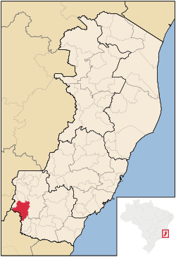
Location in Espírito Santo state
(2020 [1])
Guaçuí is a municipality located in the Brazilian state of Espírito Santo. Its population was 31,122 (2020) and its area is 469 km2.[2]
The city's economy is based mainly on coffee production and livestock farming.[3]
References
- v
- t
- e

Capital: Vitória
| Afonso Cláudio |
|
|---|---|
| Guarapari | |
| Santa Teresa | |
| Vitória |

| Linhares | |
|---|---|
| Montanha | |
| São Mateus |
| Barra de São Francisco | |
|---|---|
| Colatina | |
| Nova Venécia |
| Alegre | |
|---|---|
| Cachoeiro de Itapemirim | |
| Itapemirim |
Authority control databases | |
|---|---|
| International |
|
| National |
|
 | This geographical article relating to Espírito Santo is a stub. You can help Wikipedia by expanding it. |
- v
- t
- e


