Hauho
You can help expand this article with text translated from the corresponding article in Finnish. (June 2023) Click [show] for important translation instructions.
- Machine translation, like DeepL or Google Translate, is a useful starting point for translations, but translators must revise errors as necessary and confirm that the translation is accurate, rather than simply copy-pasting machine-translated text into the English Wikipedia.
- Do not translate text that appears unreliable or low-quality. If possible, verify the text with references provided in the foreign-language article.
- You must provide copyright attribution in the edit summary accompanying your translation by providing an interlanguage link to the source of your translation. A model attribution edit summary is
Content in this edit is translated from the existing Finnish Wikipedia article at [[:fi:Hauho]]; see its history for attribution. - You may also add the template
{{Translated|fi|Hauho}}to the talk page. - For more guidance, see Wikipedia:Translation.
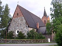
Former municipality in Tavastia Proper, Finland

Coat of arms

Location of Hauho in Finland
(2008-12-31)[2]
Hauho is a former municipality of Finland. It was situated in the province of Southern Finland and is today a part of the region of Tavastia Proper (Kanta-Häme / Egentliga Tavastland).
Hauho was amalgamated with the municipality of Hämeenlinna on 1 January 2009. Prior to the amalgamation, Hauho – which was unilingually Finnish – had had a population of 3,934 (31 December 2008)[3] and covered an area of 443.13 square kilometres (171.09 sq mi) of which 86.42 square kilometres (33.37 sq mi) was water.[1] The population density was 11.1 inhabitants per square kilometre (29/sq mi).
It has been calculated that Hauho lies at Finland's "population-centre" (Weber point), that is to say: the point in Finland closest on average to the place of residence of every inhabitant of the country.
Lakes Iso-Roine, Hauhonselkä, and Ilmoilanselkä are located in Hauho.
References
- ^ a b "Area by municipality as of 1 January 2008" (PDF) (in Finnish and Swedish). Land Survey of Finland. Archived from the original (PDF) on 2011-08-07. Retrieved 2 May 2010.
- ^ "Population by municipality as of 31 December 2008". Population Information System (in Finnish and Swedish). Population Register Center of Finland. Archived from the original on 2010-12-02. Retrieved 2 May 2010.
- ^ Population Register Center of Finland Archived 2010-12-02 at the Wayback Machine
External links
![]() Media related to Hauho at Wikimedia Commons
Media related to Hauho at Wikimedia Commons
- v
- t
- e

Authority control databases | |
|---|---|
| International |
|
| National |
|
 | This Southern Finland location article is a stub. You can help Wikipedia by expanding it. |
- v
- t
- e


