Jaltenco
Municipality and town in Mexico, Mexico

Seal
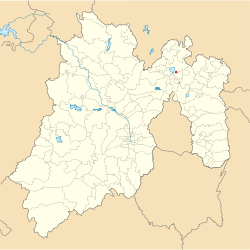
Location of the municipality in Mexico State
 Mexico
 (2005)
Jaltenco is the municipality located in Zumpango Region, a small municipality on this region, covers an area of 4.7 km², this territory is in the northeastern part of the state of Mexico in Mexico. The municipal seat is San Andrés Jaltenco, although both are commonly called only San Andrés. The municipality is located at a northern pass leading out of the Valley of Mexico to 60 kilometers north of Mexico City and about 200 km northeast of the state capital of Toluca.
As of 2005, the municipality had a total population of 26,359.[1]
Geography
The location of the municipality is north of the Mexico City, and is located in the low extreme geographical coordinates of Greenwich, north latitude 19º45'23" minimum, 19º46'28" maximum, west longitude 99°05'30" minimum, 99°06'35" maximum.[2]
The town of San Andrés Jaltenco, a municipal seat, has governing jurisdiction over the following to Arboledas Jaltenco. The total municipality extends 4,7 km2 and borders with the municipalities of Zumpango and Nextlalpan. The area of this municipality is 15 km² (59.85 sq mi).
Flora and fauna
90% of Jaltenco municipality is urbanized; all territory is plane lands, live here small mammals as mouse, rabbit, bat and gopher, birds as sparrow. The flora is century plants, prickly pears, chollas and others.[3]
References
- ^ "Jaltenco". Enciclopedia de los Municipios de México. Instituto Nacional para el Federalismo y el Desarrollo Municipal. Archived from the original on March 4, 2007. Retrieved June 6, 2009.
- ^ Jaltenco municipality INEGI, 2009.
- ^ Jaltenco Archived 2016-10-09 at the Wayback Machine INAFED.
- v
- t
- e

Toluca (capital)
- Acambay
- Acolman
- Aculco
- Almoloya de Alquisiras
- Almoloya de Juárez
- Almoloya del Río
- Amanalco
- Amatepec
- Amecameca
- Apaxco
- Atenco
- Atizapán
- Atizapán de Zaragoza
- Atlacomulco
- Atlautla
- Axapusco
- Ayapango
- Calimaya
- Capulhuac
- Chalco de Díaz Covarrubias
- Chapa de Mota
- Chapultepec
- Chiautla
- Chicoloapan
- Chiconcuac
- Chimalhuacán
- Coacalco de Berriozábal
- Coatepec Harinas
- Cocotitlán
- Coyotepec
- Cuautitlán
- Cuautitlán Izcalli
- Donato Guerra
- Ecatepec de Morelos
- Ecatzingo
- El Oro
- Huehuetoca
- Hueypoxtla
- Huixquilucan
- Ixtapaluca
- Ixtapan de la Sal
- Ixtapan del Oro
- Ixtlahuaca
- Jaltenco
- Jilotepec
- Jilotzingo
- Jiquipilco
- Jocotitlán
- Joquicingo
- Juchitepec
- La Paz
- Lerma
- Luvianos
- Malinalco
- Melchor Ocampo
- Metepec
- Mexicaltzingo
- Morelos
- Naucalpan de Juárez
- Nextlalpan
- Nezahualcóyotl
- Nicolás Romero
- Nopaltepec
- Ocoyoacac
- Ocuilan
- Otumba
- Otzoloapan
- Otzolotepec
- Ozumba
- Papalotla
- Polotitlán
- Rayón
- San Antonio la Isla
- San Felipe del Progreso
- San José del Rincón
- San Martín de las Pirámides
- San Mateo Atenco
- San Simón de Guerrero
- Santo Tomás
- Soyaniquilpan de Juárez
- Sultepec
- Tecámac
- Tejuplico
- Temamatla
- Temascalapa
- Temascalcingo
- Temascaltepec
- Temoaya
- Tenancingo de Degollado
- Tenango del Aire
- Tenango del Valle
- Teoloyucan
- Teotihuacán
- Tepetlaoxtoc
- Tepetlixpa
- Tepotzotlán
- Tequixquiac
- Texcaltitlán
- Texcalyacac
- Texcoco
- Tezoyuca
- Tianguistenco
- Timilpan
- Tlalmanalco
- Tlalnepantla de Baz
- Tlatlaya
- Toluca
- Tonatico
- Tonanitla
- Tultepec
- Tultitlán
- Valle de Bravo
- Valle de Chalco Solidaridad
- Villa de Allende
- Villa del Carbón
- Villa Guerrero
- Villa Victoria
- Xalatlaco
- Xonacatlán
- Zacazonapan
- Zacualpan
- Zinacantepec
- Zumpahuacán
- Zumpango

Authority control databases | |
|---|---|
| International |
|
| National |
|


