Kuivaniemi
Former municipality in Northern Ostrobothnia, Finland

Coat of arms
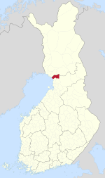
Location of Kuivaniemi in Finland
(2006-12-31)[2]
Kuivaniemi is a former municipality of Finland.
It was located in the province of Oulu and is part of the Northern Ostrobothnia region. The municipality had a population of 1,977 on 31 December 2006[2] (ranked 351st) and covered a land area of 927.21 square kilometres (358.00 sq mi) on 1 January 2006.[1] The population density was 2.1 inhabitants per square kilometre (5.4/sq mi).
The municipality was unilingually Finnish.
Kuivaniemi was incorporated into Ii municipality on 1 January 2007. The formed municipality inherited Kuivaniemi's seal-sporting coat of arms.
References
- ^ a b "Area by municipality as of 1 January 2006" (PDF) (in Finnish and Swedish). Land Survey of Finland. Retrieved 11 April 2010.[permanent dead link]
- ^ a b "Population by municipality as of 31 December 2006". Population Information System (in Finnish and Swedish). Population Register Center of Finland. Retrieved 11 April 2010.[permanent dead link]
External links
![]() Media related to Kuivaniemi at Wikimedia Commons
Media related to Kuivaniemi at Wikimedia Commons
- v
- t
- e

| Authority control databases: National |
|
|---|
 | This Oulu Province location article is a stub. You can help Wikipedia by expanding it. |
- v
- t
- e


