Lata River
River in Samoa
13°39′S 172°24′W / 13.650°S 172.400°W / -13.650; -172.400 • coordinates
• elevation
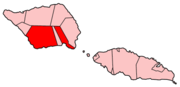
The Lata River is a river on the island of Savai'i in the Pacific island nation of Samoa. It is located in the south of the island, flowing through the Palauli district.
The river's course begins in a broad valley in the Central Savai'i Rainforest. Its course is generally southerly, flowing close to the boundary with Satupa'itea district. It passes through the small town of Sili, where it is joined by a major tributary, before reaching the Pacific Ocean at the settlement of Puleia. At its mouth, the river flows over a small cataract, Mu Pagoa Waterfall.[1]
References
- ^ a b "Lata River," Mapcarta. Retrieved 22 December 2019.
- v
- t
- e
 Palauli District: Itūmālō
Traditional center: Vailoa
- Taga Blowholes
- Lata River
- Pulemelei Mound
- Archaeological sites
- Palauli 1
- Palauli 2
- Palauli 3
 | This article about a geographical location in Samoa is a stub. You can help Wikipedia by expanding it. |
- v
- t
- e
This article related to a river in Oceania is a stub. You can help Wikipedia by expanding it. |
- v
- t
- e


