Lubbeek
Municipality in Flemish Community, Belgium

Flag

Coat of arms
Location of Lubbeek


Lubbeek
Location in Belgium 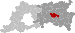
Location of Lubbeek in Flemish Brabant

 Belgium
 (2018-01-01)[1]
3210-3212
24066
Lubbeek (Dutch pronunciation: [ˈlʏbeːk]) is a municipality located in the Belgian province of Flemish Brabant. The municipality comprises the towns of Binkom, Linden, Lubbeek proper and Pellenberg. On January 1, 2006, Lubbeek had a total population of 13,660. The total area is 46.13 km² which gives a population density of 296 inhabitants per km². It is a part of the police zone Bierbeek-Boutersem-Holsbeek-Lubbeek.[2] The inventory of Flemish heritage sites lists a number of sites as heritage sites in Lubbeek including a number of former windmills, churches, mansions and homes.[3]
References
External links
 Media related to Lubbeek at Wikimedia Commons
- Official website - Available only in Dutch


- v
- t
- e
- Affligem
- Asse
- Beersel
- Bever
- Dilbeek
- Drogenbos
- Galmaarden
- Gooik
- Grimbergen
- Halle
- Herne
- Hoeilaart
- Kampenhout
- Kapelle-op-den-Bos
- Kraainem
- Lennik
- Liedekerke
- Linkebeek
- Londerzeel
- Machelen
- Meise
- Merchtem
- Opwijk
- Overijse
- Pepingen
- Roosdaal
- Sint-Genesius-Rode
- Sint-Pieters-Leeuw
- Steenokkerzeel
- Ternat
- Vilvoorde
- Wemmel
- Wezembeek-Oppem
- Zaventem
- Zemst

- Bold indicates cities
- Italic indicates municipalities with language facilities
Authority control databases | |
|---|---|
| International |
|
| Geographic |
|
 | This Flemish Brabant location article is a stub. You can help Wikipedia by expanding it. |
- v
- t
- e


