Ochapowace 71
Indian reserve in Canada, Ochapowace
Ochapowace 71 | |
|---|---|
Indian reserve | |
| Ochapowace Indian Reserve No. 71 | |
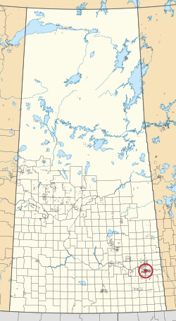 Location in Saskatchewan | |
| First Nation | Ochapowace |
| Country | Canada |
| Province | Saskatchewan |
| Area | |
| • Total | 13,970.6 ha (34,522.1 acres) |
| Population (2016)[2] | |
| • Total | 426 |
| • Density | 3.0/km2 (7.9/sq mi) |
| Community Well-Being Index[3] | 61 |
Ochapowace 71 is an Indian reserve of the Ochapowace Nation in Saskatchewan.[1][4] It is 8 kilometres northeast of Broadview. In the 2016 Canadian Census, it recorded a population of 426 living in 126 of its 138 total private dwellings.[2] In the same year, its Community Well-Being index was calculated at 61 of 100, compared to 58.4 for the average First Nations community and 77.5 for the average non-Indigenous community.[3]
References
- ^ a b "Reserve/Settlement/Village Detail". Crown–Indigenous Relations and Northern Affairs Canada. Government of Canada. Retrieved August 12, 2019.
- ^ a b "Census Profile, 2016 Census". Statistics Canada. February 8, 2017. Retrieved 2019-08-10.
- ^ a b "The Community Well-Being index". Indigenous Services Canada. 2019-05-24. Retrieved 2019-10-09.
- ^ "Canada Lands Survey System - CLSS Map Browser". Natural Resources Canada. Retrieved 2019-10-09.
- v
- t
- e
band governments
| Agency Chiefs Tribal Council (Spiritwood) | |
|---|---|
| Battlefords Agency Tribal Chiefs (North Battleford) | |
| Battlefords Tribal Council (North Battleford) | |
| File Hills Qu'Appelle Tribal Council (Fort Qu'Appelle) | |
| Meadow Lake Tribal Council (Meadow Lake) | |
| Prince Albert Grand Council (Prince Albert) | |
| Saskatoon Tribal Council (Saskatoon) | |
| Touchwood Agency Tribal Council (Punnichy) | |
| Yorkton Tribal Administration (Yorkton) | |
| Unaffiliated | |
| Not federally recognized |
| |||||
|---|---|---|---|---|---|
| Cities |  | ||||
| Towns | |||||
| Villages | |||||
| Resort villages | |||||
| Rural municipalities | |||||
| First Nations | |||||
| Indian reserves |
| ||||
| Unincorporated communities |
| ||||
50°28′34″N 102°23′57″W / 50.4762°N 102.3992°W / 50.4762; -102.3992 (Ochapowace 71)
 | This article about a location in the Census Division No. 5 of Saskatchewan is a stub. You can help Wikipedia by expanding it. |
- v
- t
- e
 | This article about an Indian reserve in Saskatchewan is a stub. You can help Wikipedia by expanding it. |
- v
- t
- e


