Porto Walter
08°16′08″S 72°44′38″W / 8.26889°S 72.74389°W / -8.26889; -72.74389
Place in Acre, Brazil

Flag
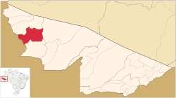
Location of municipality in Acre State


Porto Walter
Location in Brazil
 Brazil
 (2020 est [1])
Porto Walter ([ˈpoʁtu ˈwawteʁ] or [ˈvawteʁ]) is a municipality located in the west of the Brazilian state of Acre. Its population is 12,241 and its area is 6,136 km2.
The municipality contains 27% of the 846,633 hectares (2,092,080 acres) Serra do Divisor National Park, created in 1989.[2]
References
- v
- t
- e

Capital: Rio Branco
- Assis Brasil
- Brasiléia
- Epitaciolândia
- Xapuri

- Acrelândia
- Bujari
- Capixaba
- Plácido de Castro
- Porto Acre
- Rio Branco
- Senador Guiomard
- Cruzeiro do Sul
- Mâncio Lima
- Marechal Thaumaturgo
- Porto Walter
- Rodrigues Alves
 | This Acre, Brazil location article is a stub. You can help Wikipedia by expanding it. |
- v
- t
- e


