Prainha, Praia
Beach in Cape Verde
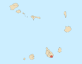
Neighbourhood in Praia, Santiago Island, Cape Verde
14°54′20″N 23°30′43″W / 14.9055°N 23.512°W / 14.9055; -23.512 (2010)
Prainha is a subdivision of the city of Praia in the island of Santiago, Cape Verde. Its population was 309 at the 2010 census.[1] It is situated on the coast, south of the city centre. Adjacent neighbourhoods are Achada Santo António to the north and Quebra Canela to the west. Several foreign embassies are located in Prainha.

The most notable landmark is Dona Maria Pia Lighthouse, located on Ponta Temerosa, the island's southernmost point.
References
Wikimedia Commons has media related to Prainha, Praia.
- ^ "2010 Census results Santiago". Instituto Nacional de Estatística Cabo Verde (in Portuguese). 24 November 2016.
- v
- t
- e
City of Praia
- Achada Grande Frente
- Achada Grande Tras
- Achada Santo António
- Achadinha
- Bairro Craveiro Lopes
- Calabaceira
- Chã de Areia
- Fazenda
- Lem Ferreira
- Palmarejo
- Plateau
- Ponta de Água
- Prainha
- Quebra Canela
- São Francisco
- Terra Branca
- Tira Chapéu
- Várzea
- Vila Nova

- Cape Verdean National Archives (ANCV)
- Museu Etnográfico da Praia
- National Auditorium
- National Library of Cape Verde
- Quintal da Música
- Tabanka
- Capture of Santiago (1585)
- Battle of Porto Praya (1780)
- Cape Verde
- Barlavento
- Santiago
- Praia


