Rock Dell, Minnesota
Unincorporated community in Minnesota, United States
43°55′15″N 92°38′19″W / 43.92083°N 92.63861°W / 43.92083; -92.6386155920, 55940, and 55976
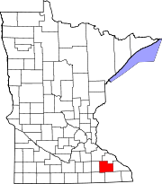
Rock Dell is an unincorporated community in Rock Dell Township, Olmsted County, Minnesota, United States. The community is located near the junction of Olmsted County Roads 3, 26, and 126. The South Fork of the Zumbro River flows through the community. Nearby places include Byron, Hayfield, Stewartville, and Rochester.
References
- ^ "Rock Dell, Minnesota". Geographic Names Information System. United States Geological Survey, United States Department of the Interior.
- v
- t
- e
Municipalities and communities of Olmsted County, Minnesota, United States
County seat: Rochester
communities
‡This populated place also has portions in an adjacent county or counties
- Minnesota portal
- United States portal
This article about a location in Olmsted County, Minnesota is a stub. You can help Wikipedia by expanding it. |
- v
- t
- e


