Spodnja Branica
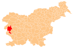
Place in Slovenian Littoral, Slovenia
45°50′33.96″N 13°49′46.03″E / 45.8427667°N 13.8294528°E / 45.8427667; 13.8294528 Slovenia
 (2002)
Spodnja Branica (pronounced [ˈspoːdnja bɾaˈniːtsa]) is a village in western Slovenia in the Municipality of Nova Gorica.[2] It is located southeast of Branik (formerly known as Rihemberk), just below the Karst Plateau.
References
External links
 Media related to Spodnja Branica at Wikimedia Commons
- Spodnja Branica on Geopedia
- v
- t
- e
Administrative seat: Nova Gorica
| Current |
|
|---|---|
| Former |
|
- Nevin Birsa
- Valter Birsa
- Matej Bor
- Jure Franko
- Ivo Hvalica
- Klement Jug
- Boris Kalin
- Zdenko Kalin
- Vasja Klavora
- Danilo Kovačič
- Janko Kralj
- Branko Marušič
- Tomaž Marušič
- Iztok Mlakar
- Dušan Pirjevec Ahac
- Marko Anton Plenčič
- Vojteh Ravnikar
- Gianni Rijavec
- Leon Rupnik
- Igor Simčič
- Mojca Širok
- Stanislav Škrabec
- Josip Srebrnič
- Jože Srebrnič
- Boštjan Vuga
- Danilo Zavrtanik
- Vasilij Žbogar
 | This article about the Municipality of Nova Gorica in Slovenia is a stub. You can help Wikipedia by expanding it. |
- v
- t
- e


