Tópaga
Municipality and town in Boyacá Department, Colombia

Flag

Location of the municipality and town of Tópaga in the Boyacá Department of Colombia
 Colombia
(2020-2023)
(2015)
Tópaga (Spanish pronunciation: [ˈtopaɣa]) is a town and municipality in the Sugamuxi Province, part of the Colombian department of Boyacá. Tópaga is situated on the Altiplano Cundiboyacense with the urban center at an altitude of 2,900 metres (9,500 ft) while the topography varies over the municipality from 2,400 metres (7,900 ft) to 3,200 metres (10,500 ft). It borders Nobsa and Corrales in the west, in the east Mongua and Gámeza, in the north Gámeza and in the south Monguí and Sogamoso. Department capital Tunja is 98 kilometres (61 mi) away. Chicamocha River flows through Tópaga.[1]
Etymology
The name Tópaga comes from Chibcha and means "Behind father river".[2]
History
Before the Spanish conquest, Tópaga was inhabited by the Muisca. The village was ruled by a cacique with the same name as the village, loyal to the iraca of Sugamuxi. The iraca was educated by messenger god Bochica according to the religion of the Muisca.[1]
Modern Tópaga was founded in 1593 by Álvaro Leiva.[1]
Economy
Main economical activity of Tópaga is coal mining, used to produce electrical energy.[1]
Gallery
-
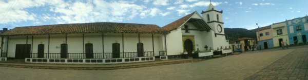
 Central square
 -
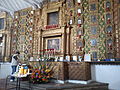 Chapel interior


Panorama
References
- ^ a b c d (in Spanish) Official website Tópaga
- ^ (in Spanish) Etymology Tópaga - Excelsio.net
Wikimedia Commons has media related to Tópaga.
- v
- t
- e

See also: List of municipalities in Boyacá
5°46′N 72°50′W / 5.767°N 72.833°W / 5.767; -72.833


