Teuchern
Town in Saxony-Anhalt, Germany

Coat of arms
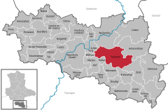
Location of Teuchern within Burgenlandkreis district
(2017–24) Marcel Schneider[1] (Ind.)
(2022-12-31)[2]
06680–06682
Teuchern is a town in the Burgenlandkreis district, in Saxony-Anhalt, Germany. It is situated approximately 10 km southeast of Weißenfels. On 1 January 2011 it absorbed the former municipalities Deuben, Gröben, Gröbitz, Krauschwitz, Nessa, Prittitz and Trebnitz.[3] These 7 former municipalities and Teuchern proper are now Ortschaften or municipal divisions of the town Teuchern.[4]
Sons and daughters of the town
- Reinhard Keiser, composer, (1674-1739)
- Johann Christian Schieferdecker, organist and composer, (1679-1732)
- Peter Meyer, keyboardist and saxophonist of the Puhdys, (born 1940 in Wildschütz)
- Jürgen Pahl, football goalkeeper, (born 1956)
References
- ^ Bürgermeisterwahlen in den Gemeinden, Endgültige Ergebnisse, Statistisches Landesamt Sachsen-Anhalt, accessed 8 July 2021.
- ^ "Bevölkerung der Gemeinden – Stand: 31. Dezember 2022" (PDF) (in German). Statistisches Landesamt Sachsen-Anhalt. June 2023.
- ^ Gebietsänderungen vom 01. Januar bis 31. Dezember 2011, Statistisches Bundesamt
- ^ Hauptsatzung der Stadt Teuchern, July 2019.
- v
- t
- e
Towns and municipalities in the district of Burgenlandkreis
- An der Poststraße
- Bad Bibra
- Balgstädt
- Droyßig
- Eckartsberga
- Elsteraue
- Finne
- Finneland
- Freyburg
- Gleina
- Goseck
- Gutenborn
- Hohenmölsen
- Kaiserpfalz
- Karsdorf
- Kretzschau
- Lanitz-Hassel-Tal
- Laucha an der Unstrut
- Lützen
- Meineweh
- Mertendorf
- Molauer Land
- Naumburg
- Nebra
- Osterfeld
- Schnaudertal
- Schönburg (Saale)
- Stößen
- Teuchern
- Weißenfels
- Wethau
- Wetterzeube
- Zeitz

Authority control databases | |
|---|---|
| International |
|
| National |
|
| Geographic |
|
 | This Burgenlandkreis location article is a stub. You can help Wikipedia by expanding it. |
- v
- t
- e


