Wolmaransstad
Place in North West, South Africa
27°13′0″S 25°58′28″E / 27.21667°S 25.97444°E / -27.21667; 25.97444 (2011)[1]
2630
2630
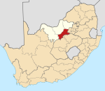
Wolmaransstad (Afrikaans for "Wolmarans City") is a maize-farming town situated on the N12 between Johannesburg and Kimberley in North West Province of South Africa. The town lies in an important alluvial diamond-mining area and it is the main town of the Maquassi Hills Local Municipality.

Town 245 km south-west of Johannesburg and 56 km north-east of Bloemhof. It was laid out on the farms Rooderand and Vlakfontein in 1888, and proclaimed a town in 1891. Named after Jacobus M. A. Wolmarans, then member of the Executive Council.[2]
Wolmaransstad originated in 1891 on the banks of the Makwasi River (San word for a type of wild spearmint) and takes its name from J. M. A. Wolmarans, a volksraad councilman.
Wolmaransstad serves a large community and is an important diamond buying center.
The Dutch Reformed church building was designed by Gerard Moerdijk.
Anglo Boer war
Tourist attractions
- Broadbent Mission Station [3]
- Digger's Diamond route [4]
- Makwassierante Conservation Area
- Wolwespruit Dam Nature Reserve
Notable native
- Bernardus Gerhardus Fourie (also known as Brand Fourie; 1916–2008), South African politician
See also
- Wolmaransstad Commando, a former light infantry regiment of the South African Army based in Wolmaransstad
References
Places adjacent to Wolmaransstad | |
|---|---|


Wikimedia Commons has media related to Wolmaransstad.
- v
- t
- e
Municipalities and communities of Dr Kenneth Kaunda District Municipality, North West
District seat: Klerksdorp
- Boskuil
- Kgakala
- Leeudoringstad
- Makwassie
- Rulaganyang
- Trotsville
- Tswelelang
- Witpoort
- Wolmaransstad
Authority control databases | |
|---|---|
| International |
|
| National |
|
| Geographic |
|
 | This North West Province location article is a stub. You can help Wikipedia by expanding it. |
- v
- t
- e


