Xanxerê
Place in South, Brazil

Flag

Seal
Portuguese: Capital Estadual do Milho (The state capital of corn)
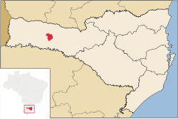
Location in Santa Catarina
(2020 [2])
89820-000
Xanxerê (Portuguese pronunciation: [ʃɐ̃.ʃeˈɾe]) is a city in Santa Catarina, southern Brazil. Italian and German are the mainstream cultures, having been brought by immigrants in the early 20th century through the migration of the "gauchos".
The city is one of the main production centers of maize in Brazil and serves as an important industrial, commercial and service center for western Santa Catarina. It is located in a key position for trades via Mercosul.
Xanxerê is the headquarters of the Association of Cities of Alto Irani (AMAI), composed of 17 "municípios".
On April 20, 2015, a destructive tornado hit the city. Many homes and businesses were severely damaged or destroyed, two people died, and another 120 were injured. The tornado was rated F3 on the Fujita Scale, according meteorologists. At least 2,600 homes were damaged or destroyed.[4][5]
Climate
| Climate data for Xanxerê, elevation 841 m (2,759 ft), (1976–2005) | |||||||||||||
|---|---|---|---|---|---|---|---|---|---|---|---|---|---|
| Month | Jan | Feb | Mar | Apr | May | Jun | Jul | Aug | Sep | Oct | Nov | Dec | Year |
| Record high °C (°F) | 36.2 (97.2) | 34.0 (93.2) | 34.0 (93.2) | 30.8 (87.4) | 29.6 (85.3) | 28.1 (82.6) | 28.2 (82.8) | 30.6 (87.1) | 32.5 (90.5) | 33.2 (91.8) | 34.8 (94.6) | 35.0 (95.0) | 36.2 (97.2) |
| Mean daily maximum °C (°F) | 28.1 (82.6) | 27.6 (81.7) | 26.7 (80.1) | 23.9 (75.0) | 21.5 (70.7) | 19.9 (67.8) | 19.9 (67.8) | 21.7 (71.1) | 22.5 (72.5) | 24.3 (75.7) | 26.2 (79.2) | 27.7 (81.9) | 24.2 (75.5) |
| Daily mean °C (°F) | 21.1 (70.0) | 20.9 (69.6) | 19.8 (67.6) | 16.8 (62.2) | 14.2 (57.6) | 12.8 (55.0) | 12.4 (54.3) | 14.0 (57.2) | 15.2 (59.4) | 17.0 (62.6) | 18.9 (66.0) | 20.5 (68.9) | 17.0 (62.5) |
| Mean daily minimum °C (°F) | 15.8 (60.4) | 15.9 (60.6) | 14.6 (58.3) | 11.4 (52.5) | 8.9 (48.0) | 7.8 (46.0) | 7.1 (44.8) | 8.4 (47.1) | 9.9 (49.8) | 11.5 (52.7) | 12.9 (55.2) | 14.8 (58.6) | 11.6 (52.8) |
| Record low °C (°F) | 4.0 (39.2) | 3.0 (37.4) | 3.6 (38.5) | 0.0 (32.0) | −3.8 (25.2) | −11.6 (11.1) | −11.1 (12.0) | −7.9 (17.8) | −3.8 (25.2) | 0.0 (32.0) | 1.6 (34.9) | 4.4 (39.9) | −11.6 (11.1) |
| Average precipitation mm (inches) | 190.0 (7.48) | 177.0 (6.97) | 155.0 (6.10) | 141.0 (5.55) | 170.0 (6.69) | 169.0 (6.65) | 148.0 (5.83) | 116.0 (4.57) | 196.0 (7.72) | 239.0 (9.41) | 172.0 (6.77) | 190.0 (7.48) | 2,063 (81.22) |
| Average relative humidity (%) | 81 | 82 | 82 | 82 | 83 | 83 | 81 | 79 | 79 | 79 | 77 | 78 | 81 |
| Mean monthly sunshine hours | 215 | 201 | 181 | 174 | 187 | 152 | 174 | 179 | 159 | 198 | 210 | 216 | 2,246 |
| Source 1: Empresa Brasileira de Pesquisa Agropecuária (EMBRAPA)[6] | |||||||||||||
| Source 2: Instituto Nacional de Meteorologia (INMET),[7]Climatempo (precipitation)[8] | |||||||||||||
References
- ^ "Área territorial oficial" [Official Territorial Area] (in Portuguese). Brazilian Institute of Geography and Statistics (IBGE). 2002-10-10. Retrieved 2014-12-03.
- ^ IBGE 2020
- ^ "Ranking decrescente do IDH-M dos municípios do Brasil" [Ranking of HDI-M of Brazilian Municipalities] (PDF) (in Portuguese). United Nations Development Programme (UNDP). 2010. Retrieved 2013-08-03.
- ^ Fritz, Angela (22 April 2015). "Deadly tornado destroys parts of Xanxere city in Brazil (Video)". Washington Post. Retrieved 11 May 2015.
- ^ "Inmet confirma tornado em Xanxerê, no Oeste catarinense". 21 April 2015.
- ^ "Atlas climático da Região Sul do Brasil: Estados do Paraná, Santa Catarina e Rio Grande do Sul" (PDF). EMBRAPA. Archived from the original (PDF) on 14 January 2024. Retrieved 25 May 2024.
- ^ "Instituto Nacional de Meteorologia". Instituto Nacional de Meteorologia. Retrieved 2015-06-23.
- ^ "Climatology in Xanxerê, BR". Climatempo. Retrieved 25 May 2024.
- v
- t
- e


- mesoregions of Santa Catarina
- Grande Florianópolis
- Norte Catarinense
- Oeste Catarinense
- Serrana
- Sul Catarinense
- Vale do Itajaí
- Águas de Chapecó
- Águas Frias
- Bom Jesus do Oeste
- Caibi
- Campo Erê
- Caxambu do Sul
- Chapecó
- Cordilheira Alta
- Coronel Freitas
- Cunha Porã
- Cunhataí
- Flor do Sertão
- Formosa do Sul
- Guatambú
- Iraceminha
- Irati
- Jardinópolis
- Maravilha
- Modelo
- Nova Erechim
- Nova Itaberaba
- Novo Horizonte
- Palmitos
- Pinhalzinho
- Planalto Alegre
- Quilombo
- Saltinho
- Santa Terezinha do Progresso
- Santiago do Sul
- São Bernardino
- São Carlos
- São Lourenço do Oeste
- São Miguel da Boa Vista
- Saudades
- Serra Alta
- Sul Brasil
- Tigrinhos
- União do Oeste
 | This Santa Catarina, Brazil location article is a stub. You can help Wikipedia by expanding it. |
- v
- t
- e


