Baška Voda
Gemeente in Kroatië  | |||
|---|---|---|---|
  | |||
| Situering | |||
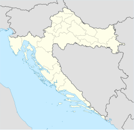
| Land | Kroatië | ||
| Provincie | Split-Dalmatië | ||
| Coördinaten | 43° 21′ NB, 16° 57′ OL | ||
| Algemene informatie | |||
| Oppervlakte | 19 km² | ||
| Inwoners (2001) | 2924 | ||
| Overig | |||
| Postcode(s) | 21320 | ||
| |||

Baška Voda (Italiaans: Bascavoda, Bestonio of Fontana di Bestonio) is een gemeente in de Kroatische provincie Split-Dalmatië.
Baška Voda telt 2924 inwoners. De oppervlakte bedraagt 19 km², de bevolkingsdichtheid is 153,9 inwoners per km².


Steden en gemeenten in de provincie Split-Dalmatië
Steden (gradovi): Split · Hvar · Imotski · Kaštela · Komiža · Makarska · Omiš · Sinj · Solin · Stari Grad · Supetar · Trilj · Trogir · Vis · Vrgorac · Vrlika
Gemeenten (općine): Baška Voda · Bol · Brela · Cista Provo · Dicmo · Dugi Rat · Dugopolje · Gradac · Hrvace · Jelsa · Klis · Lećevica · Lokvičići · Lovreć · Marina · Milna · Muć · Nerežišća · Okrug · Otok · Podbablje · Podgora · Podstrana · Postira · Prgomet · Primorski Dolac · Proložac · Pučišća · Runovići · Seget · Selca · Sućuraj · Sutivan · Šestanovac · Šolta · Tučepi · Zadvarje · Zagvozd · Zmijavci
Geplaatst op:
20-07-2008
20-07-2008
Dit artikel is een beginnetje over landen & volken. U wordt uitgenodigd om op bewerken te klikken om uw kennis aan dit artikel toe te voegen.

Mediabestanden
Zie de categorie Baška Voda van Wikimedia Commons voor mediabestanden over dit onderwerp.


