Eagle, Idaho
| Eagle | |
| city | |
 | |
| Land |  USA USA |
|---|---|
| Delstat | Idaho |
| County | Ada County |
| Koordinater | 43°45′27″N 116°25′5″V / 43.75750°N 116.41806°V / 43.75750; -116.41806 |
| Yta | 76,1 km² (2010)[1] |
| - land | 74,9 km² |
| - vatten | 1,2 km² |
| Folkmängd | 19 908 (2010)[2] |
| Befolkningstäthet | 266 invånare/km² |
| Tidszon | MST (UTC-7) |
| - sommartid | MDT (UTC-6) |
| ZIP-kod | 83616, 83646, 83714[3] |
| FIPS | 1623410 |
| Geonames | 5591778 |
  Ortens läge i Idaho | |
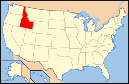 Idahos läge i USA | |
Eagle är en stad i Ada County i delstaten Idaho, USA med 19 254 invånare (2007).
Källor
- ^ ”2010 Census Gazetteer Files”. US Census Bureau. Arkiverad från originalet den 14 juli 2012. https://www.webcitation.org/699nOulzi?url=http://www.census.gov/geo/www/gazetteer/files/Gaz_places_national.txt. Läst 14 juli 2012.
- ^ ”Eagle (city), Idaho” (på engelska). State & County Quickfacts. U.S. Census Bureau,. Arkiverad från originalet den 24 juli 2012. https://www.webcitation.org/69Opee9MG?url=http://quickfacts.census.gov/qfd/states/16/1623410.html. Läst 24 juli 2012.
- ^ ”2010 ZIP Code Tabulation Area (ZCTA) Relationship Files”. U.S. Census Bureau. 11 maj 2010. Arkiverad från originalet den 25 augusti 2012. https://www.webcitation.org/6ABdwXxbq?url=http://www.census.gov/geo/www/2010census/zcta_rel/zcta_place_rel_10.txt. Läst 25 augusti 2012.
| ||||||||||


