Camaquã
Municipality in Rio Grande do Sul, Brazil

Flag

Seal
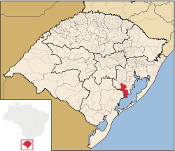
Location within Rio Grande do Sul
 Brazil
 Rio Grande do Sul
 (2020 [1])
Camaquã is a municipality in the state of Rio Grande do Sul, Brazil.
The municipality contains part of the 7,993 hectares (19,750 acres) Camaquã State Park, which was created in 1975.[3]
See also
Wikimedia Commons has media related to Camaquã.
References
- ^ IBGE 2020
- ^ "Archived copy" (PDF). United Nations Development Programme (UNDP). Archived from the original (PDF) on July 8, 2014. Retrieved August 1, 2013.
{{cite web}}: CS1 maint: archived copy as title (link) - ^ Parque Estadual do Camaquã (in Portuguese), SEMA: Secretaria do Ambiente e Desenvolvimento Sustentável (RS), retrieved 2017-01-22
- v
- t
- e
Capital: Porto Alegre
Mesoregion Centro Ocidental Rio-Grandense | |||||||
|---|---|---|---|---|---|---|---|
| |||||||

Mesoregion Metropolitana de Porto Alegre | |||||||||||||
|---|---|---|---|---|---|---|---|---|---|---|---|---|---|
| |||||||||||||
Mesoregion Nordeste Rio-Grandense | |||||||
|---|---|---|---|---|---|---|---|
| |||||||
Mesoregion Noroeste Rio-Grandense | |||||||||||||||||||||||||||
|---|---|---|---|---|---|---|---|---|---|---|---|---|---|---|---|---|---|---|---|---|---|---|---|---|---|---|---|
| |||||||||||||||||||||||||||
Mesoregion Sudeste Rio-Grandense | |||||||||
|---|---|---|---|---|---|---|---|---|---|
| |||||||||
Mesoregion Sudoeste Rio-Grandense | |||||||
|---|---|---|---|---|---|---|---|
| |||||||
 | This geographical article relating to Rio Grande do Sul is a stub. You can help Wikipedia by expanding it. |
- v
- t
- e


