Cerro Batoví


Cerro Batoví
Uruguay
Uruguay
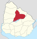
Cerro Batoví is a hill in Uruguay, with an altitude of 224 metres (734.9 ft). It is situated 25 km (15.5 mi) away from the city of Tacuarembó.
Location and features
It is located in the Tacuarembó Department, in a range of hills named Cuchilla de Haedo. Batoví means "breast of a virgin" in the Guaraní language and the hill has this name due to its curious shape.
Cerro Batoví is considered the symbol of the Tacuarembó Department.
See also
- Breast-shaped hill
- Cerro Catedral
- Cerro de las Ánimas
- Cerro Pan de Azúcar
- Geography of Uruguay
External links
- (in Spanish) Enciclopedia Geográfica del Uruguay.
Wikimedia Commons has media related to Cerro Batoví.
- v
- t
- e

Capital: Tacuarembó
- Ansina
- Paso de los Toros
- San Gregorio de Polanco
villages
- Cerro Batoví
 | This article about a place in Tacuarembó Department is a stub. You can help Wikipedia by expanding it. |
- v
- t
- e
 | This South America mountain, mountain range, or peak related article is a stub. You can help Wikipedia by expanding it. |
- v
- t
- e


