Paso Bonilla
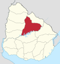
Village in Tacuarembó Department, Uruguay
32°9′0″S 56°7′0″W / 32.15000°S 56.11667°W / -32.15000; -56.11667 Uruguay
 (2011)
45011
Paso Bonilla is a village or populated centre in the Tacuarembó Department of northern-central Uruguay.
Geography
The village is located on the junction of Route 5 with Route 59, about 10 kilometres (6.2 mi) south of the department capital city Tacuarembó. About 1.5 kilometres (0.93 mi) north of the village is the so-called "Paso Bonilla", which coincides with the actual bridge of Route 5 over the stream Arroyo Tranqueras.[citation needed]
Population
In 2011 Paso Bonilla had a population of 510.[1]
| Year | Population |
|---|---|
| 1963 | 74 |
| 1975 | 368 |
| 1985 | 743 |
| 1996 | 286 |
| 2004 | 445 |
| 2011 | 510 |
Source: Instituto Nacional de Estadística de Uruguay[2]
References
External links
Wikimedia Commons has media related to Paso Bonilla.
- INE map of Paso Bonilla
- v
- t
- e
 Tacuarembó Department of Uruguay
Capital: Tacuarembó
- Ansina
- Paso de los Toros
- San Gregorio de Polanco
villages
- Achar
- Ansina
- Curtina
- Las Toscas
- Paso Bonilla
- Paso de los Toros
- Paso del Cerro
- San Gregorio de Polanco
- Tacuarembó
- Tambores
 | This article about a place in Tacuarembó Department is a stub. You can help Wikipedia by expanding it. |
- v
- t
- e


