Rio de Contas
Municipality of Bahia State, Brazil
Municipality in Bahia, Brazil

Flag

Seal
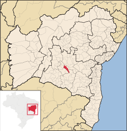
Location in Bahia
 Brazil
 Bahia
Bahia (2021)[1]
Rio de Contas is a municipality in the Bahia state, in the eastern part of Brazil. Its estimated population as of 2020[update] was 12,932.[3]
Rio de Contas has its origins in the 18th century. In 1718 the town of Santo Antônio de Mato Grosso was founded. It was later elevated to the status of municipality in 1773, with the designation of Vila Nova de Nossa Senhora do Livramento das Minas do Rio de Contas. Its named was shortened in 1840 to Minas do Rio de Contas, and in 1931 to Rio de Contas.[4]
For many arriving from the south, it is the gateway to Chapada Diamantina. It stands at 1,200 metres (3,900 ft) above sea level.
Historic structures
Rio de Contas is home to numerous colonial-period historic structures, many designated as Brazilian national monuments. The historic center of Rio de Contas (Conjunto Arquitetônico da Cidade de Rio de Contas) was designated a national monument by the National Institute of Historic and Artistic Heritage (IPHAN).[5]
- Town Hall and Prison of Rio de Contas (Antiga Casa de Câmara e Cadeia de Rio de Contas)
- House at Rua Barão de Macaúbas, 11 (Casa à Rua Barão de Macaúbas, 11)
- Birthplace of Abílio César Borges at Rua Barão de Macaúbas, 19 (Casa Natal de Abílio César Borges, à rua Barão de Macaúbas, 19)
- Parish Church of the Blessed Sacrament (Igreja Matriz do Santíssimo Sacramento)
- Church of Our Lady of Santana (Ruínas da Igreja de Santana)[4]
References
- ^ "IBGE Rio de Contas". IBGE. Retrieved 21 October 2022.
- ^ "Archived copy" (PDF). United Nations Development Programme (UNDP). Archived from the original (PDF) on July 8, 2014. Retrieved August 1, 2013.
{{cite web}}: CS1 maint: archived copy as title (link) - ^ IBGE 2020
- ^ a b Azevedo, Paulo Ormindo de (2013). "Rio de Contas". Lisbon, Portugal: Heritage of Portuguese Influence/Património de Influência Portuguesa. Retrieved 2020-08-05.
- ^ "Ruínas da Igreja de Santana". Salvador, Brazil: IPAC. 2020. Retrieved 2020-08-05.
- v
- t
- e
Capital: Salvador
Mesoregion Centro Norte Baiano | |||||||||||
|---|---|---|---|---|---|---|---|---|---|---|---|
| |||||||||||

Mesoregion Centro Sul Baiano | |||||||||||||||||
|---|---|---|---|---|---|---|---|---|---|---|---|---|---|---|---|---|---|
| |||||||||||||||||
Mesoregion Extremo Oeste Baiano | |||||||
|---|---|---|---|---|---|---|---|
| |||||||
Mesoregion Metropolitana de Salvador | |||||||
|---|---|---|---|---|---|---|---|
| |||||||
Mesoregion Nordeste Baiano | |||||||||||||
|---|---|---|---|---|---|---|---|---|---|---|---|---|---|
| |||||||||||||
Mesoregion Sul Baiano | |
|---|---|
Mesoregion Vale São-Franciscano da Bahia | |||||||||
|---|---|---|---|---|---|---|---|---|---|
| |||||||||
Authority control databases | |
|---|---|
| International |
|
| National |
|
13°34′44″S 41°48′39″W / 13.57889°S 41.81083°W / -13.57889; -41.81083
 | This Bahia, Brazil location article is a stub. You can help Wikipedia by expanding it. |
- v
- t
- e


